Cherokee Reservoir falls in Grainger County, part of Tennessee. The surroundings are pine and hardwood. It covers about 27.5 sq miles, which means weather matters as much as tactics. There is far more edge than the surface area suggests, thanks to the arms. By surface area it heads our Grainger County listings. Rutledge lies 6.4 miles from the water. Morristown is 7 miles and Jefferson City 8.4 miles. The county edge is within a short distance of the bank.
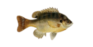
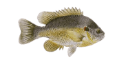
The books put it at 156 ft. Look for where the old bank line still shows under the surface. A reservoir gives you a hard edge, a shelf, and not much else. Public occurrence data for Grainger County names brown trout, white sucker, bluegill, greenside darter and rainbow trout. The county list is broader than any single water. The shape of Cherokee Reservoir decides where the fish sit.
Between January at about 36°F and July at about 76°F, the water has a wide range to work through. Heat sets the pattern from late spring onward. The first and last hours carry the summer; the middle is slow. June to September is hot work, so the first and last hours are what count. That shapes the year on Cherokee Reservoir.
The shoreline is public, so the licence is the main requirement. A made slipway is half a mile from here, which settles the boat question. A pier half a mile from here gives a platform over deeper water. Parking space is the usual limit rather than the bank itself. Where tickets apply, they are sold in the nearest town rather than on the bank. For a change of water, Panther Lake is 3 miles distant. Confirm access to Cherokee Reservoir locally before you travel.
31%
The bites are poor now


| 00 | 01 | 02 | 03 | 04 | 05 | 06 | 07 | 08 | 09 | 10 | 11 | 12 | 13 | 14 | 15 | 16 | 17 | 18 | 19 | 20 | 21 | 22 | 23 |
| 7.1 | 8 | 7.2 | 3.1 | 6 | 6.9 | 6.1 | 7.8 | 8.9 | 13.4 | 12.9 | 12.6 | 11.3 | 12.4 | 12.5 | 12.7 | 10 | 8.4 | 7.5 | 6.6 | 6.7 | 7.9 | 7.3 | 7.8 |
| 55° | 56° | 55° | 54° | 54° | 54° | 53° | 53° | 52° | 51° | 51° | 51° | 53° | 53° | 54° | 53° | 52° | 51° | 50° | 48° | 47° | 46° | 45° | 44° |
| 0 | 0 | 0 | 0 | 0 | 0 | 0 | 0 | 0 | 0 | 0 | 0 | 0 | 0 | 0 | 0 | 0 | 0 | 0 | 0 | 0 | 0 | 0 | 0 |
| 29.73 | 29.7 | 29.69 | 29.69 | 29.68 | 29.68 | 29.68 | 29.7 | 29.73 | 29.74 | 29.75 | 29.76 | 29.77 | 29.75 | 29.76 | 29.76 | 29.77 | 29.77 | 29.77 | 29.78 | 29.79 | 29.8 | 29.81 | 29.81 |
| 78 | 84 | 93 | 92 | 94 | 95 | 95 | 92 | 87 | 84 | 81 | 74 | 68 | 64 | 61 | 61 | 65 | 66 | 67 | 71 | 74 | 78 | 82 | 84 |
-83.42045, 36.23620
-83.42545, 36.23953
-83.44295, 36.22926
-83.41879, 36.24731
-83.44545, 36.22148
-83.41904, 36.25126
-83.44712, 36.22092
-83.44823, 36.22314
-83.42879, 36.20537
-83.43795, 36.20231
-83.43227, 36.19991
-83.45184, 36.20759
-83.39379, 36.25565
-83.42573, 36.19315
-83.46462, 36.21092
-83.46200, 36.20592
-83.37578, 36.25539
-83.39018, 36.26703
-83.36184, 36.24398
-83.38163, 36.18731
-83.48616, 36.23176
-83.45210, 36.27725
-83.48882, 36.23665
-83.46573, 36.17842
-83.46490, 36.17203
-83.50408, 36.22148
-83.34904, 36.18391
-83.36184, 36.28676
-83.35601, 36.28287
-83.48833, 36.17365

Sam
AI Fishing Assistant for Cherokee Reservoir
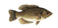
A grey, even sky over the water, with a busy WNW wind on the open water and pressure ticking upward. Odds at Cherokee Reservoir are best on Rock bass near flooded cover along the old banks. Plan around the stretch from afternoon into evening. Change depth before you change anything else. Cooler water spreads fish back across the shallows.
The bites are poor now
Night
Morning
Afternoon
Evening
Best bite time
Best bite time
Best bite time
Best bite time
Best bite time
Best bite time
Best bite time