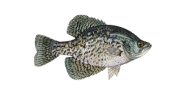
A bright day with hardly any cloud, with next to no ripple with a firming glass. At Lake Oroville, expect Black crappie close to the shallows early and the drop later. Plan around the stretch from the day. Keep moving until you find them. Cooler water spreads fish back across the shallows.

The bites are average now
Night
Lake Oroville stands in Butte County, California. Height above sea level is 876 feet. This is big water, about 16.6 sq miles, and in a wind it behaves like a small sea. Some 107 miles of shoreline means conditions can differ from one end to the other. Nothing else we list in Butte County covers more water. Head to Oroville East, 3.5 miles away, for anything you forgot. Further out sit Oroville (6.4 miles) and Berry Creek (6.5 miles). One jurisdiction covers this water end to end.
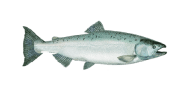
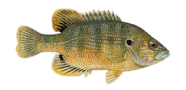
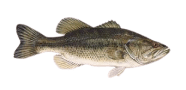
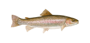
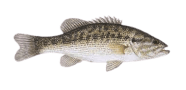
190 ft is what our records show. Held water runs deepest at the wall and shallows back to the inflow. A reservoir gives you a hard edge, a shelf, and not much else. Fish documented in Butte County include green sturgeon, Chinook salmon, striped bass and rainbow trout. At least one recorded species is protected in parts of its range; read the local rules before targeting anything. Work Lake Oroville in sections rather than trying to cover it.
July is the warm end of the year here, averaging about 77°F, while January sits near 46°F. Summer heat is the limit here, not winter cold. March through May is the strongest run, with autumn a second stretch. November and March are the quiet, comfortable months to be out. Lake Oroville runs to its own calendar within the local pattern.
Public land surrounds it, and access follows the standard rules. Formal access is not mapped, so the last stretch is likely on foot. A small crankbait along the drop and a worm in the thick stuff cover the bass. Season dates differ by species, so read the table. Signs go up and come down, so check on the day. Should this one be busy, Miners Ranch Reservoir is 3.5 miles off. Confirm access to Lake Oroville locally before you travel.
46%
The bites are average now


| 00 | 01 | 02 | 03 | 04 | 05 | 06 | 07 | 08 | 09 | 10 | 11 | 12 | 13 | 14 | 15 | 16 | 17 | 18 | 19 | 20 | 21 | 22 | 23 |
| 3.6 | 0.9 | 1.6 | 3.4 | 5.2 | 4.3 | 3.6 | 3.9 | 2 | 1.3 | 2 | 4.3 | 6.1 | 6.6 | 5.7 | 4.6 | 4.2 | 3.1 | 2.6 | 2.8 | 2.3 | 2.6 | 3.3 | 4.1 |
| 55° | 55° | 55° | 54° | 54° | 53° | 53° | 53° | 55° | 61° | 65° | 67° | 68° | 69° | 70° | 70° | 69° | 64° | 61° | 58° | 57° | 56° | 55° | 55° |
| 0 | 0 | 0 | 0 | 0 | 0 | 0 | 0 | 0 | 0 | 0 | 0 | 0 | 0 | 0 | 0 | 0 | 0 | 0 | 0 | 0 | 0 | 0 | 0 |
| 30.04 | 30.05 | 30.05 | 30.05 | 30.05 | 30.06 | 30.06 | 30.06 | 30.06 | 30.07 | 30.07 | 30.08 | 30.06 | 30.06 | 30.06 | 30.06 | 30.06 | 30.07 | 30.07 | 30.07 | 30.09 | 30.1 | 30.1 | 30.1 |
| 54 | 56 | 57 | 57 | 58 | 58 | 55 | 52 | 46 | 38 | 32 | 30 | 32 | 34 | 34 | 34 | 39 | 56 | 57 | 63 | 64 | 61 | 58 | 56 |
-121.49104, 39.54932
-121.44053, 39.53908
-121.48295, 39.57184
-121.45413, 39.58766
-121.43969, 39.53211
-121.45182, 39.53009
-121.44302, 39.59294
-121.41080, 39.57461
-121.42358, 39.59128
-121.46636, 39.60127
-121.41497, 39.59516
-121.39431, 39.57256
-121.39830, 39.58600
-121.38382, 39.52970
-121.52039, 39.52402
-121.36552, 39.52461
-121.52681, 39.61765
-121.55010, 39.51773
-121.55313, 39.51782
-121.56699, 39.54550
-121.44525, 39.64850
-121.56553, 39.53128
-121.34496, 39.52072
-121.42441, 39.64877
-121.33274, 39.53378
-121.41580, 39.65655
-121.39858, 39.65183
-121.37691, 39.64294
-121.42497, 39.66516
-121.32774, 39.60961
Sam
AI Fishing Assistant for Lake Oroville
Morning
Afternoon
Evening
Best bite time
Best bite time
Best bite time
Best bite time
Best bite time
Best bite time
Best bite time