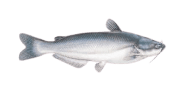
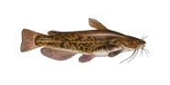
Wind working the surface all day, with the NNE wind calling the shots today with the glass holding level. Brown bullhead should stay active around channel edges and moving water at Chesapeake Bay. A slow day overall; the night is the best of a quiet lot. Scale down and fish slowly. Cooling water has fish active and on the move.

The bites are poor now
Night
Morning
10%
The bites are poor now


| 00 | 01 | 02 | 03 | 04 | 05 | 06 | 07 | 08 | 09 | 10 | 11 | 12 | 13 | 14 | 15 | 16 | 17 | 18 | 19 | 20 | 21 | 22 | 23 |
| 25.5 | 27 | 25.9 | 25 | 26.1 | 27.3 | 27 | 26.4 | 32.1 | 34.7 | 33 | 33.8 | 34.2 | 32.9 | 32.6 | 31 | 31 | 30.3 | 30.7 | 29.8 | 30.9 | 30.7 | 30.6 | 30.5 |
| 69° | 68° | 67° | 66° | 65° | 65° | 63° | 64° | 62° | 59° | 59° | 58° | 57° | 56° | 56° | 56° | 57° | 58° | 58° | 57° | 57° | 56° | 55° | 57° |
| 0 | 0 | 0 | 0 | 0 | 0 | 0 | 0 | 0 | 0.1 | 0.1 | 0 | 0 | 0.1 | 0.1 | 0 | 0 | 0 | 0 | 0 | 0 | 0 | 0 | 0 |
| 29.85 | 29.88 | 29.88 | 29.88 | 29.9 | 29.92 | 29.94 | 29.95 | 29.99 | 30.03 | 30.08 | 30.11 | 30.13 | 30.15 | 30.16 | 30.16 | 30.19 | 30.2 | 30.23 | 30.26 | 30.29 | 30.31 | 30.34 | 30.35 |
| 82 | 80 | 80 | 79 | 77 | 76 | 82 | 80 | 84 | 84 | 80 | 79 | 79 | 78 | 76 | 72 | 67 | 62 | 61 | 58 | 56 | 56 | 55 | 54 |
Sam
AI Fishing Assistant for Chesapeake Bay
Afternoon
Evening
Best bite time
Best bite time
Best bite time
Best bite time
Best bite time
Best bite time
Best bite time