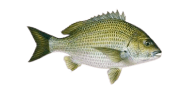
Cloud from horizon to horizon today, with a consistent blow out of the SSW with pressure climbing. The water to watch at Port Adelaide River is eddies behind cover for Southern black bream. The morning carries the best of the day. Ride the conditions while they last. Pre-summer fish are feeding up and mobile.

The bites are excellent now
Night
Morning
Afternoon
Evening
80%
The bites are excellent now


| 00 | 01 | 02 | 03 | 04 | 05 | 06 | 07 | 08 | 09 | 10 | 11 | 12 | 13 | 14 | 15 | 16 | 17 | 18 | 19 | 20 | 21 | 22 | 23 |
| 19.1 | 20.7 | 21.8 | 19.9 | 20.6 | 21.2 | 18 | 16.6 | 16.1 | 16.9 | 17.7 | 17.6 | 18.1 | 19.1 | 21.4 | 23.8 | 24.6 | 25.6 | 27.5 | 27.1 | 23.7 | 21.6 | 18.7 | 17.7 |
| 14° | 14° | 14° | 14° | 14° | 14° | 13° | 13° | 13° | 14° | 14° | 15° | 15° | 15° | 16° | 16° | 16° | 16° | 16° | 16° | 16° | 15° | 14° | 13° |
| 0 | 0 | 0 | 0 | 0 | 0 | 0 | 0 | 0 | 0 | 0 | 0 | 0 | 0 | 0 | 0 | 0 | 0 | 0 | 0 | 0 | 0 | 0 | 0 |
| 1024 | 1025 | 1025 | 1024 | 1024 | 1024 | 1025 | 1025 | 1026 | 1027 | 1028 | 1028 | 1028 | 1027 | 1027 | 1027 | 1026 | 1026 | 1026 | 1027 | 1028 | 1029 | 1030 | 1030 |
| 65 | 64 | 63 | 63 | 64 | 64 | 65 | 66 | 66 | 64 | 60 | 55 | 56 | 56 | 56 | 59 | 59 | 58 | 57 | 57 | 56 | 60 | 63 | 65 |
Best bite time
Best bite time
Best bite time
Best bite time
Best bite time
Best bite time
Best bite time
Sam
AI Fishing Assistant for Port Adelaide River